County Limerick
The Vikings reached this area in the 10th century and founded the town of Limerick. We crossed over the River Shannon to St. John’s Castle, situated beside the river. A massive structure which has recently been restored, we again just viewed it from the outside and inside in the gift shop. There, I bought a book of Limericks. I was going to put them in this travelogue but I can’t find it now. The castle was built between 1200-1219 A.D. by King John, the English King who ruled over Ireland after the Anglo-Norman conquest.
A few blocks down, we came upon St. Mary’s Cathedral, erected in 1177. Donal O’Brien, the King of Munster was the founder of this beautiful church which is now Protestant. Lovely gardens surround the edifice. We planned to drive to Tralee on N69 along the Shannon River. At its end, it’s called the mouth and estuary and not Lough Shannon like in other parts of Ireland. Perhaps the current makes a difference or that this is the largest river in Ireland. I had seen all of this area from the air when we made the stop at Shannon.
|
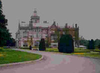
Adare Manor House |
Seeing the ruins of a castle and church, we consulted our map and decided we could go on N21 and be able to see the town of Adare, which was highly touted in some guidebooks. We drove around the grounds of Adare Manor House, which is another grand hotel with a golf course. It was built like a castle in the 19th century. Adare had several thatched-roof cottages but the streets were torn up. So I didn’t find it any more picturesque than most other Irish villages, which have brightly-painted buildings, interesting lanes and pubs.
County Kerry
We made no more stops as we traveled on N21 to Castleisland, then turned right on N21 and went around Tralee. I had wanted to go see this city but my TC (Travel Companion) said we would miss the Dingle Peninsula if we did stop, so we opted to go on. Located at the end of Tralee Bay is the Blennerville windmill, where we stopped for a quick photo, then proceeded along the northern coast of the Dingle Peninsula on Route 559. The Mish Mountains were on our left.
The colorful, red, covered wagons of the tinkers were on the road, mainly giving tourists and children a ride in these distinctive horse-drawn means of conveyance. Traveling along Tralee Bay passing the small Castlegregory Peninsula, we came to the wide, sandy beaches along Brandon Bay. Leaving Mt. Brandon, the second tallest mountain in Ireland, in the distance, we turned left on Route 618 to go over Connor Pass.
A bleak, barren, mountainous area, still green in most places, but totally rocky in other parts, was the view we encountered. Looking down on the valley from the heights of Connor Pass, we saw four or five small lakes dotting the landscape, as the wind howled around us. Cutting straight across the Dingle Peninsula, Connor Pass is the highest in Ireland. What make all of these peninsulas so stunning are the high mountains which plunge directly into the sea. The interior of Ireland is, for the most part, flat.
We quickly descended into the town of Dingle. You could just tell from the look of the place that interesting things occur here on a regular basis. Though overrun with tourists, they leave by this time of day and Dingle keeps its village quality like Donegal. We drove to the far side of the town where we encountered a group of B&B’s on the hillside overlooking Dingle Harbor and its fishing fleet. It’s a good thing we arrived around five o’clock because rooms were filling up fast. There were a certain species of palm trees growing on the lawns. We were in the “tropical” part of Ireland.
Hastily putting our luggage in our room, we took off to explore the tip of the Dingle Peninsula called Slea Head. We didn’t realize what was in store for us. The prettiest, most dramatic, spectacular part of our journey was just ahead. I have friends who were born in County Kerry and they have never seen this place. It has always been raining hard or fogged in. We still had good weather. We just hoped the light would last!
|
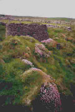
Dunbeg Fort |
Driving along the coastal road in a clockwise manner for a change, we passed through Ventry and stopped at Dunbeg Fort. We walked out to the cliffs, full of pink, cascading wildflowers, as they plunged into the sea. An Iron Age promontory fort, which projects itself south into Dingle Bay, it is like similar ones which date from 500 B.C. to 500 A.D. A circular, stone wall enclosed individual stone houses, half of which were underground, or connected to each other by underground passages.
The view was simply magnificent, with the blue sea crashing on the rocks below, the sheer cliffs, and the wildflowers abloom and abounding far and wide. Atop the cliffs were the green meadows, inhabited by the ubiquitous white sheep with black faces, who went down to the edge of the precipice.
Continuing on, we could now see the Blasket Islands in the distance. Some call these the most westerly land in Europe. I wonder what Iceland has to say about that. I have been to a cape is Portugal, which claims to be the most westerly point of continental Europe. Also, I had traveled to the most easterly part of North America, in Newfoundland. On my first trip to Europe, I had crossed the Atlantic on a Danish freighter so I have covered all this area.
|
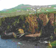
Slea Head Ferry |
A lone, fishing boat was heading back to Dingle Harbor as we headed for Dunquin. Here at the end of the peninsula is a spectacular ferry site, set at the bottom of the steepest and most spectacular cliff. We decided to take the ferry road down to the sea but it was closed. It only opens in the summer for daytrippers to go to the Blasket Islands. Though uninhabited today (the last family left in 1953), they were the place where you could find “the happiest people in the world.”
At Dunquin we stopped to have a beer at Kruger’s Lounge. On its walls were pictures of the two main films shot here; the beautiful, unforgettable tale of Ryan’s Daughter, directed by David Lean and the more forgettable Far and Away movie with Tom Cruise. Many of the locals were in both endeavors. We were back in Gaeltacht country with all the signs in Gaelic, no English. This area has a wide sandy strand, some standing stone monoliths, and a view of three similar peaks called the Three Sisters. One man told us the “standing stones are sacred because the fairies dance around them at night.”
At the Gallarus Oratory, we met one of the nicest and most helpful ticket-takers we encountered. He was so proud of his region and told us many stories of the place. I asked about St. Brendan because I knew he took off for the New World from this region. The man directed us to the site of St. Brendan’s departure and also told us of St. Brendan’s church and house nearby.
The Gallurus Oratory is an example of an early Christian church, constructed of stone, at an angle, whereby the wall becomes the roof as well. This marvelous structure, built without mortar, has withstood the onslaught of fierce winds and rain for twelve hundred years. Christians made a great distinction of holding their services indoors in a building as opposed to the Celts who held their rituals outdoors. The oak tree was especially sacred to the Celtic religion.
In this treeless environment, it suddenly dawned upon me, “Was Christianity responsible for the de-forestation of Europe?” It preached nothing about saving the natural surroundings. Men acted naturally clearing the land of trees so they could use it for meaningful pursuits such as cultivating crops or pastures for their livestock. They also cut the trees to use as lumber for their homes and to build ships. Only in the late 20th century have we learned that global deforestation affects our atmosphere and environment. I applaud the many reforestation projects I came across in Ireland and can only hope for more.
The ruins of Kilmalkedun were huge as compared to the small Gallarus Oratory. Built three hundred years later in the 12th century, the influence of Christianity had grown immensely. Another surprise a little further on were the large ruins of a two-story house said to be that of St. Brendan. This would make it date to the 5th century. Perhaps this is another bit of blarney. From here, the road continues on to Mt. Brandon and is known as “the saint’s road.” But we took the better-surfaced road through Ballydavid. I admired a church built in the same style, as the one I had liked so much in Donegal.
|
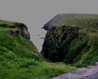
Spot where St. Brendan left for the New World |
The road ended at Brandon Creek with Mt. Brandon behind, slowing becoming covered in the fog. Down below in the water were still several fishing boats. This is the spot where St. Brendan took off in his currough for the New World. Tim Severin proved that this journey could have taken place in the 5th century in the type of boat St. Brendan used. He made a journey to America from Ireland in a replica of the boat and wrote of it in The Brendan Voyage. I have studied the pre-Columbian art of Mexico. The Indians have sculptures of a European man with a beard, done long before the arrival of Columbus.
Although St. Brendan’s story is well-believed in Ireland and elsewhere, others think it’s just another example of blarney. To mark the site of this history-making departure, the Irish humor is very apparent. There is a sculpture of St. Brendan sitting in something like a bathtub with a sail attached to it.
We took the road, which led straight across the peninsula from Brandon’s Creek to the outskirts of Dingle. The fog was getting lower and lower and the light was disappearing. I was able to take a great picture of an Irish farmstead with the fog descending upon it. But just a few miles future, I came to the best site for a photo – a thatch-roofed homestead. I took the shot but it is almost in utter darkness in my print.
The ticket-taker from the Galleries Oratory had kindly called ahead to the An Bother Pub further up on this road to alert the owner that he had some customers heading his way. The owner had said he would keep his kitchen open for us. So we were very glad to pull into this lovely place at about eight-thirty. We didn’t realize that it would take such a long time to go such a short distance but we had made many stops.
|
An Bother Pub |
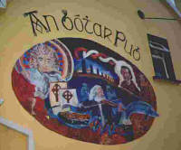
An intriguing painting was on the side of the golden-yellow building. The name was written in Gaelic above the large, oval mural, depicting a golden-haired St. Brendan in the upper left with his boat below him; another cleric on the right at the end of a long row of standing, Celtic stones; a dolphin jumping out of the picture (Dingle Bay is known for its dolphins); and in the center, a long-haired man with a white beard, hauntingly playing his fiddle. A model of the real boat St. Brendan used was inside.
Another young couple with three children, one a baby, owned the place. He was the bartender and she was the cook-waitress. These people are thriving in the countryside due to the tourists who come there. Fortunately, for us, we never encountered any tourists as we were on a completely different time schedule. We had savory, big bowls of vegetable soup, which we consumed near a roaring peat fire. It was very romantic but wasn’t really needed, as the weather was not that cold.
Back in Dingle, we set out for a pub. There were several with traditional music around the harbor area. But we remembered the one we had seen when we first came into the town and settled on that one. Au Codair was its name and it was full. About twelve musicians were playing various instruments, including a bagpipe. There were tourists around but you had the feeling that the musicians were playing for their own entertainment. They didn’t even get free pints of Guinness like in Donegal.
In every place we’ve been with music, we just had to pay for our drinks. There was never a cover charge. Another young couple were the owners, the wife being the bartender and the husband playing the fiddle. He helped out at the bar when the wife got swamped. I sat at the bar while my TC found a place near the musicians. He met a Norwegian stock-broker, who is semi-retired and living in Ballydavid. The man told him that there was some Irish dancing just a few doors down the road. It was instrumental music here tonight. Last night they had had singing.
After a thoroughly delightful time in this locale, we went searching for Irish dancing. There were no places down the road, just B&B’s, so we went in the car down the main street of town and stopped at a hotel. The woman at the counter gave my TC directions on how to find the place with the dancing. We rode all around but couldn’t find it so finally gave up. Today had truly been incredible!
This was the first place we stayed where I never met our host or hostess. They weren’t very kind so it was just as well. My TC went down for breakfast, which ended at nine o’clock again. He was able to bring up a tray, but they would only allow me one egg. We were told we had to vacate the premises by ten o’clock.
Driving along Route 559 through Anascaul to Inch, beautiful Dingle Bay, glowing an aquamarine hue in the sunlight, was on our right. We walked out on Inch Strand, a gorgeous, white, wide sandy beach jutting into the Bay. But the wind was so strong, we gave up walking and returned to our car. I didn’t want to get blinded by getting some sand in my eye.
We continued on Route 559 until we came to Castlemain, where we took N70 to Killorglin. Turning right we were on the Iveragh Peninsula, better known as the Ring of Kerry. I had read one person’s travelogue of her trip to Ireland before I left on mine. She was with a tour group traveling in May. She had stated that the Ring of Kerry was so full of tour buses that she could hardly see any of the sights, even when they stopped. We had left later and were traveling counterclockwise so we were blessed and didn’t have any of her problems.
A tinker was beside the road in front of his trailer. Before him were tables set up with wares for sale. A good-looking, blond, friendly character, he was selling some reasonably-priced brass objects. These included medallions with a harp, a jaunting cart, the sign for Guinness beer, a Celtic cross and one saying the traditional Irish greeting “Cead Mile Failte” – a thousand welcomes, I believe. These will be my small treasures I will keep, to remind me of the wondrous place.
Two donkeys were standing over to the side with baskets full of flowers on each side of their bodies. Beyond were the green, rounded mountains, more like hills, and the golden gorse. The wind was continuing to blow so strong. The tinker called it blustery and what a perfect use of the word. I will employ it from now on.
At Cahirciveen, we gazed across the Valencia River to see the ruins of Ballycarbery Castle on Valencia Island. As N70 turned around the peninsula, we took the secondary road, which brought us to the tip of the peninsular. We were expecting spectacular views, like we had encountered yesterday at Slea Head, but there were none. Portmagee had a harbor full of colorful, fishing boats.
Stopping at a nice shop on the waterfront, we had tea and crumpets. A newspaper article was on the wall. It was dated 1979 and described this place as “one of the most desolate areas of Ireland.” What an excellent job some PR man did in Killarney, transforming the seldom-visited Iveragh Peninsula into the Ring of Kerry, the prime attraction on every tourists list – a “not to be missed” experience – in just twenty years!
Rounding the end of the peninsula, we came in sight of the Skellig Islands, scarcely more than islets of rocks. Monks lived in great hardship on these barren shores from the 7th to the 13th centuries. According to the Lonely Planet Guidebook, these monks were influenced by the Coptic Church, founded by St. Anthony in the deserts of Egypt and Libya, and their desire for soil led them to this remote, westerly corner of Europe.
As we came into Ballinskelligs Bay, we could see the remains of Ballinskelligs Monastery, probably built after the 13th century, when the monks abandoned the islands and came to live on the mainland. In the summer, one can take a boat to the islands from here. Two horses were romping on a beautiful stretch of beach as we left our car to view this scene. To the west were the remains of the 16th century castle of the McCarthys.
Halfway around the Bay, we re-joined N70. Driving on the southern side of the Ring of Kerry with the sea here called the Kenmare River, we came to an area of small cliffs where the water was dotted with many, small islands. We were told that this is the best known and most photographed view of Ireland. There was nothing unique or special about the place, just the fact that it is on a road big enough for tour busses.
On a side road before Castlecove, full of patches of yellow irises, we found Staigue Fort. Dating back to the 3rd or 4th centuries, it is one of the country’s best-preserved stone fortresses. Although it has “sweeping views of the coastline, it is hidden and can’t be seen from the sea.” From a distance, it seems to just blend into the countryside. Inside it has several flights of stairs, intact. No one knows whether this was used as a defensive structure with the village inside or as a more elaborate royal residence.
Towards the end of the Ring of Kerry ride, we came, surprisingly, upon a forested area, the first of our trip, that we actually rode through. It was nice to have trees engulfing us after so much barren, green land.
We linked up with N71 at Kenmare, a delightful town where we stopped just long enough for my TC to find an ATM machine. I stayed in the car and watched a charming scene. Two young girls were having tea, outdoors, at the lovely Horseshoe Restaurant, with hanging baskets of purple petunias. This reminded me of my childhood when we would pretend to have tea parties. These children were lucky, as they were able to do the real thing.
We missed Killarney and its attractions but we had definitely decided to stay on the coast road as much as possible. Continuing on N71, we drove across the Beara Peninsula. Another surprise was in store for us as we entered a spectacular stretch of the Caha Mountains.
