Rocks coloured all shades between friendly light green and barren dark grey, with clean fresh mountain air, lakes with water so pure one can almost see the bottom. The High Tatra mountains on the border between Poland and Slovakia offer some of the most rewarding scenery in Europe. Well-marked trails, good facilities and low costs make it an excellent destination for a summer hiking trip. The area is very popular with Polish, Slovak and Czech outdoors enthusiasts, but is still fairly unknown in the West. I first went there in 2001, and have returned every summer since, and even though it’s the smallest alpine range in Europe, I can imagine going there for many years to come and discovering new gems every year.
How to get there
 |
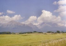
| Approaching the High Tatra Mountains |
On the Polish side, there’s Zakopane. It’s a good place for buying tacky souvenirs, but otherwise it isn’t any more interesting than Poprad, and unlike quiet Poprad, Zakopane is overrun by mostly Polish and German tourists. It can be reached by bus or train from Krakow. In theory busses are faster, but if you’re going from Krakow to Zakopane in the beginning of a weekend, or back at the end of it, expect traffic jams and consider taking the train instead. There’s a HI hostel (ul. M Zaruskiego 5) in Zakopane, and plenty of private rooms. There are internet cafes in both Poprad and Zakopane.
Maps & Trails
The best map to get is the Slovak 1/50.000 Vysoké Tatry map (nr. 113 of the Turisticka Mapa series that covers the entire country, easily recognized by the green-and-yellow look). It’s available in bookstores, tourist offices and kiosks throughout the country, and in some of the mountain huts. It shows all the color-coded trails, and how long it takes to walk them (to be taken with a grain of salt, but a good guideline), as well as mountain huts, railways, cable cars, sights, etc. You can buy maps on the Polish side too of course, but they seem to be somewhat less user-friendly.
 |
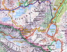
| Map of Polish Lakes |
Getting into the mountains
From Poprad, take one of the little trains to Stary Smokovec or another resort. If you want to start from Strbske Pleso this takes 1.5 hours though; going there by bus or by changing trains in Strba (on the line to Bratislava) would probably be a lot quicker. From Zakopane take a bus to Lysa Polana (on the border) or to the Morskie Oko car park (still quite a walk from Morskie Oko itself, and you have to pay to enter the national park here).
There are several cable cars and chair lifts. The most important cable car goes from Tatranska Lomnica, one of the Slovak resorts, to Skalnata lake, and will save you a hard and boring walk up. From here you can take the red trail up or down, take another cable car to Lomnicky stit, the second highest mountain in the Tatras (this means waiting in line for hours to buy an expensive ticket and then waiting some more because unless you start to queue first thing in the morning, it’s not likely you’ll get a ticket for the next one going up), or the chair lift up to Lomnicky hreben (cheaper, quicker and the view is excellent too).
Accommodations
There’s plenty of hotels, private rooms and a few campsites. Or you can stay at the mountain huts (chaty). They all provide food/drinks and bedding; but if they’re full you’ll have to crash on the floor. The coolest/smallest/most remote/most basic one is Chata pod Rysmi, 250 m (and an hour’s walk) from the top of Mt. Rysy on the Slovak side.
Weather & When to go
The most exciting trails are closed from the first of November to the 15th of June. July and August are very busy, so it’s nicest to go in June or September. If you want to cross the border after climbing Mt. Rysy, keep in mind that this is only allowed until the 30th of September – they don’t check this, but it’s for your own safety; we did it on the last day and there was so much ice it was probably quite risky already.
Typical summer weather means clear skies in the morning, and then ever more clouds appearing (and descending) throughout the day. It’s advised to start at least one hour after sunrise and get to a town or hut at least one hour before sunset. It can be quite cold and sometimes windy in the higher regions through out the year, so bring warm clothes even if it’s warm and sunny in the valley.
General Advice
Bring good shoes, a raincoat and a water bottle (water from streams or sources is generally safe to drink). It’s safest not to attempt the more difficult trails on your own. If you want to go hiking from hut to hut but not with a big pack, leave it at the left luggage office at Poprad train station and take what you need in a smaller backpack.
Trail suggestions
Tatranska Magistrala is a red-marked trail which crosses the Tatras from east to west, starting at Velke Biele pleso in the east, and continuing beyond the borders of the High Tatras map in the west. This is one of the most popular trails and, if it is your first trip, any part of this trail would be an excellent place to start. It would take about 15 to 16 hours to walk from Velke Biele pleso to the town of Podbanske in the western Tatras (or the other way ’round), but there are six mountain huts along the way so there’s no need to do it in one go. The most spectacular parts of the Magistrala are between Skalnata chata at the cable car-station and Chata pri Zelenom plese at Zelene lake (2 hours 45 minutes); and between the Sliezsky dom mountain hotel and Chata pri Popradskom plese (3 hours 30 minutes), though the zigzaggy trail directly east of Popradske lake is also the hardest part of the red trail.
 |
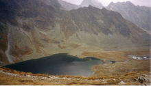
| A Lake Hidden in the High Tatras |
Popradske Pleso to Koprovsky Stit and back is is one of the nicest return hikes to be had in the Tatras. It takes about five and a half hours, and is marked blue and then red. After you get above the treeline you get good views of Rysy in the east and Satan in the west. Then you get to the Hincovo lakes, the highest lakes in Slovakia that contain fish (salmon and trout), which sometimes remain frozen well into July. Until this point it’s a moderate walk you could take with children, afterwards it gets harder but you will be rewarded by breath-taking views in all directions along the way, and from the top of Koprovsky (2363,3 m).
Important Links
High Tatras – Tourist centers, maps, photo-gallery, accommodations
High Tatras – Vysoke Tatry
Tatry mountains, hotel guide and tourist information
List of (nearly) all the mountain huts